
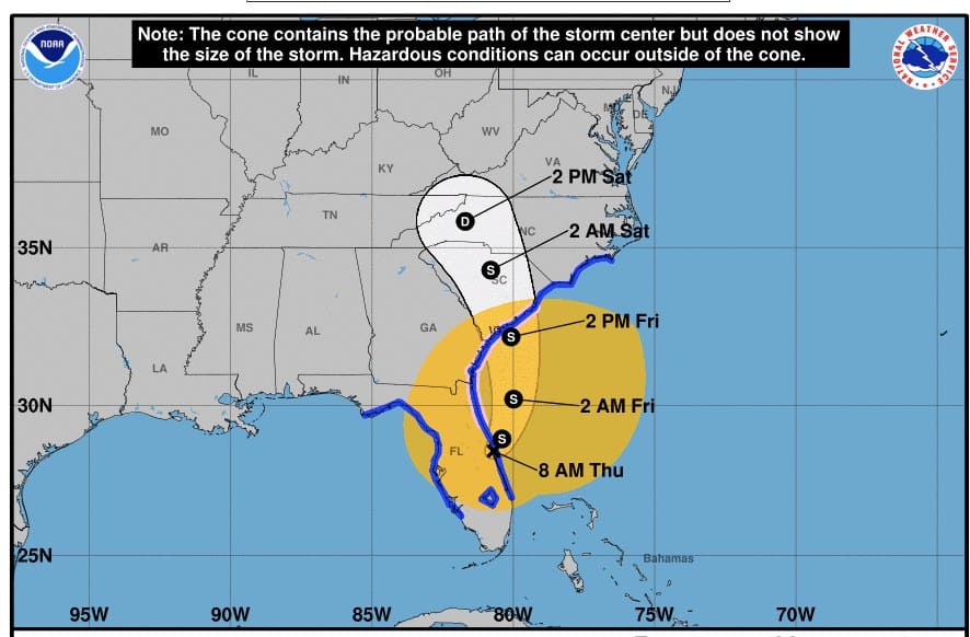
After hurricane Ian made landfall it downgraded to a tropical storm. After crossing Florida it regained strength and is once again a category 1 hurricane as it heads toward the South Carolina coastline.
An update from the National Hurricane Center Thursday evening said, the hurricane is “taking aim at the Carolinas and Georgia with life-threatening flooding, storm surge and strong winds.”
As of this evening Ian is moving north northwest at approximately 10 mph with sustained and gusting winds up to 75 mph.
https://cdn.star.nesdis.noaa.gov/…/GOES16-AL092022-13…
I hope you are all battened down and ready for some scrabble or maybe a puzzle cause its gunna be stormy over the next 24-36 hours.
Ian has pummeled Florida as we have seen from the videos and pictures coming out of the state. Our hearts go out to those who are suffering down there and wish them a speedy recovery.
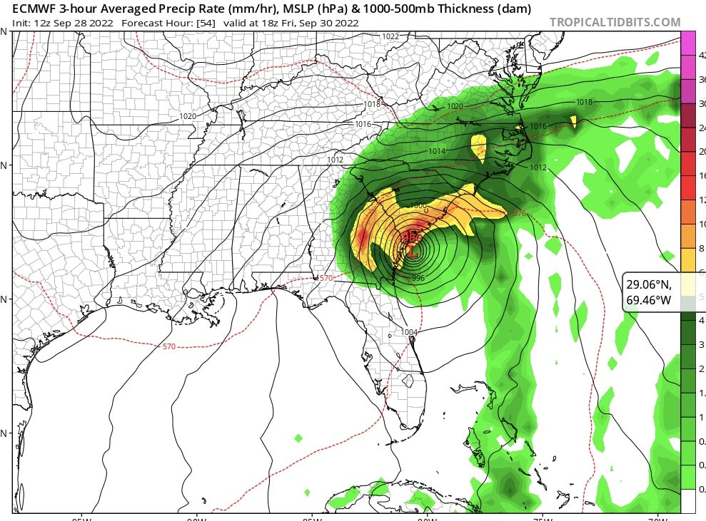
Image courtesy TropicalTidbits.com
Hurricane Ian has now become Tropical Storm Ian and is set to emerge into the Atlantic Ocean just above the Space Coast about 11am today. From there he will continue a bit NNE and then start to swing to the north and then NW. Central pressure will drop a bit (992mb down to 982mb) and will gain a little wind strength, but likely not much organization due to sheering winds aloft and its short time over the open Atlantic.
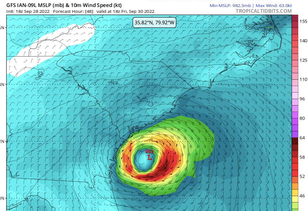
Image courtesy TropicalTidbits.com
Models show the center of the low coming ashore again a little further to the north than previously predicted – yes, closer to the Charleston area. It is scheduled to arrive in the vicinity of Edisto Island around 2pm Friday. Most of the rain will have already pounded us by the time though as the sheer is dragging it up the frontal boundary.
Be prepared for TS force winds in the 55 – 65 range with some puffs around 75 starting late morning Friday and into the afternoon/early evening. Rainfall amount hasn’t really changed much so we should plan on 6-8”.
We are in king tides right now which will be compounded by the storm surge. We are currently at high tide now (11am) and luckily no rain yet. Tomorrow will likely see more storm surge as the TS meets out coast not long after high tide (12:30pm). This will be particularly troublesome as this king tide (6.2′) will not aid in helping to drain the heavy rains. Yes – expect flooding.
Tie outdoor furniture together, move any potted plants out of wind line, collect yard debris to keep from going down drains. Check your gutters, downspouts and drain fields. Tuck away garbage cans and anything that can easily be blown around. Make sure your vehicle is on high ground and if you have a boat on a trailer outside, leave plug in so that it will be weighted down by the water it collects and less likely to be blown over.
Stay safe, sane and dry. Remember that this is just Mother Nature showing us a little of what she can do.
Bunky Wichmann is a Charleston, SC native, sailor and businessman.
Please share freely and donate to The Standard on this page to assure the continued availability of news that is ignored too often by the dominant media.


 RSS - Posts